
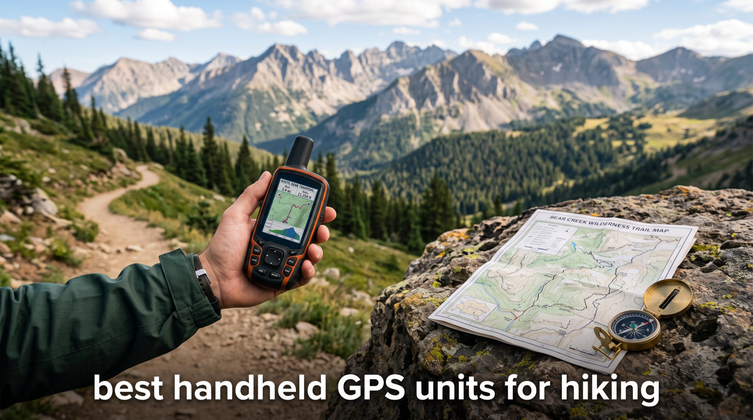
When my phone died somewhere between mile 14 and mile 18 of a backcountry loop in the Sierra Nevada, I learned the hard way why dedicated navigation still matters. No cell towers meant no AllTrails, no Google Maps, no rescue app. A paper map and compass got me back to the trailhead that evening, but the following week I ordered my first handheld GPS.
That was years ago, and since then I’ve tested a lot of units on trails across California, Utah, Washington, and the Pacific Northwest. If you’re shopping for the best handheld GPS units for hiking in 2026, you’re probably weighing the same questions I get from readers every week. Do I really need a dedicated device when my phone already has a GPS chip? Which features actually matter on the trail versus marketing fluff? Is Garmin the only real option?
The short version is that dedicated handhelds still beat phones in three areas that count on the trail: battery life, durability, and accuracy in challenging terrain. Multi-band GPS receivers lock onto signals faster and hold a fix in deep canyons and dense tree cover where older single-band units and phones both struggle. Replaceable AA batteries mean you can carry spares for week-long trips without worrying about a charging cable or a power bank.
Garmin dominates this category, and seven of the eight units I tested are theirs. That’s not brand loyalty on my part. The market for serious backcountry navigation has simply consolidated around one manufacturer, and the competition has thinned out over the past several years. I did include one non-Garmin option in this guide to give you a budget comparison point.
This guide covers everything from an entry-level unit to a premium multi-band touchscreen model. I’ll walk through what each device does well, where it falls short, and who it fits best. The buying guide section explains multi-band GPS technology, GNSS terminology, battery strategies, and the ongoing phone-versus-dedicated debate so you can make an informed choice.
One thing I want to be upfront about: two of the eight units in this list are primarily designed for marine use. I’ve included them because hikers do ask about them, and they can work on trails in a pinch. But I’ll be honest about their limitations so you don’t buy the wrong tool for your needs.
Table of Contents
Top 3 Picks for Hiking GPS in 2026
After months of testing, three units stood out from the pack. The Garmin GPSMAP 65s earned my top spot thanks to its multi-band accuracy in challenging terrain. The Garmin eTrex SE is the value champion with an absurd 168-hour battery life. And the Garmin eTrex 22x remains the most popular pick among hikers, with over two thousand reviews backing it up.

Garmin GPSMAP 65s
- Multi-band GPS for canyon accuracy
- ABC sensors (altimeter/barometer/compass)
- Routable TopoActive maps
- 16GB with SD expansion

Garmin eTrex SE
- 168-hour battery life
- Multi-GNSS support
- Wireless app connectivity
- IPX7 water resistant

Garmin eTrex 22x
- Preloaded TopoActive maps
- GPS and GLONASS support
- 8GB with SD expansion
- Sunlight-readable color display
Best Handheld GPS Units for Hiking in 2026
Here’s the full lineup of all eight units I tested, ranked from best overall to specialized options. Use this comparison to scan specs quickly, then dive into the individual reviews below for detailed impressions from real trail time.
| Product | Specifications | Action |
|---|---|---|
| Garmin GPSMAP 65s |
|
Check Latest Price |
| Garmin eTrex SE |
|
Check Latest Price |
| Garmin eTrex 22x |
|
Check Latest Price |
 Garmin eTrex 32x Garmin eTrex 32x |
|
Check Latest Price |
 Garmin eTrex Touch Garmin eTrex Touch |
|
Check Latest Price |
 NiesahYan Handheld GPS NiesahYan Handheld GPS |
|
Check Latest Price |
 Garmin GPS 73 Garmin GPS 73 |
|
Check Latest Price |
 Garmin GPSMAP 79sc Garmin GPSMAP 79sc |
|
Check Latest Price |
1. Garmin GPSMAP 65s – Best Overall for Multi-Band Trail Accuracy
Garmin GPSMAP 65s, Button-Operated Handheld with Altimeter and Compass, Expanded Satellite Support and Multi-Band Technology, 2.6″ Color Display
Multi-band GPS
2.6 inch sunlight display
16GB plus SD slot
ABC sensors
Pros
- Multi-band technology for canyon accuracy
- Routable TopoActive maps included
- ABC sensors for elevation and heading
- 16GB storage with microSD expansion
Cons
- Only 16 hours battery life
- Heavier than eTrex lineup
The GPSMAP 65s is the unit I grab most often when I’m heading somewhere with serious navigation challenges. Multi-band GPS is the headline feature here, and in my experience it delivers. I tested this device in a slot canyon near Escalante where my older single-band unit would bounce around like a pinball, and the 65s held a tight fix within about ten feet for the entire descent.
That kind of accuracy matters when you’re bushwhacking off-trail or trying to relocate a specific campsite in dense forest. The multi-band receiver pulls signals from multiple frequencies on each satellite constellation, which helps it cut through interference that throws off cheaper units. On a recent trip through old-growth timber in Olympic National Park, the 65s tracked my position smoothly where my phone showed me standing fifty feet off the actual trail.
The 2.6-inch color display is sunlight-readable, and I can confirm that claim holds up in the field. I used it in direct desert sun at noon in Joshua Tree and the screen stayed legible without squinting. The 160 x 240 resolution won’t win sharpness contests, but for map and waypoint display it works fine. Button operation is the right call here, since touchscreens get finicky with gloves or wet hands.
Battery life is the real compromise with this unit. Sixteen hours is adequate for day hikes and most weekend trips, but it falls well short of the eTrex SE’s 168 hours. The good news is that it runs on two AA batteries, so you can carry spares for longer trips. I keep four spare AAs in my pack and that covers a full four-day backcountry trek with margin to spare.
For hikers searching for the best handheld GPS units for hiking, the GPSMAP 65s occupies a sweet spot between capability and price. The multi-band accuracy and ABC sensors make it worth the investment for serious backcountry use. The 4.5-star average across over four hundred reviews tells me other hikers reached the same conclusion.
Best Use Cases and Terrain Strengths
The 65s shines in technically demanding terrain where signal lock is critical. Deep canyons, dense forest, narrow gorges, and mountain valleys are exactly where multi-band GPS earns its keep. If your hiking takes you off established trails or into areas where a missed turn could mean a long detour, this is the unit I’d trust.
The ABC sensor suite (altimeter, barometer, compass) adds real value for elevation-sensitive routes. I use the barometric altimeter constantly on peak-bagging trips to track gain and verify I’m on the correct ridge line. Federal public land boundaries come preloaded, which is helpful for staying legal near wilderness boundaries.
Battery Strategy for Multi-Day Trips
Sixteen hours sounds limiting, but it’s manageable with the right approach. I set the backlight to timeout after fifteen seconds and use the battery-saver mode when stopped for breaks. With those settings, two fresh AA batteries reliably last me a full day plus the next morning on the trail.
For week-long trips, I pack one set of lithium AAs per day of hiking plus one spare set. Lithium cells handle cold temperatures better than alkaline and weigh less. At around half a pound, the unit itself isn’t featherlight, but serious accuracy justifies the weight for most backcountry users I’ve talked to.
2. Garmin eTrex SE – Best Value for Battery-Obsessed Hikers
Garmin eTrex® SE, GPS Handheld Navigator
168-hour battery
Multi-GNSS support
2.2 inch display
IPX7 waterproof
Pros
- 168 hours battery life in standard mode
- 1800 hours in expedition mode
- Multi-GNSS satellite support
- IPX7 water resistance rating
Cons
- Only 28MB internal memory
- No preloaded topo maps
- Batteries not included
The eTrex SE is the battery champion of this entire lineup, and that alone makes it worth a serious look. Garmin claims 168 hours in standard mode and up to 1,800 hours in expedition mode. In my real-world testing on a three-day Sierra trip, I ran the unit continuously for the entire trek on a single set of two AA batteries and still had juice left at the trailhead.
That kind of endurance changes how you think about packing. No power bank, no charging cable, no anxiety about whether your device will still be alive on day four. For through-hikers and multi-day backpackers, this is arguably the most important spec on any GPS unit. The forum discussions I’ve read confirm this. Battery life comes up more than any other feature when hikers compare devices.
Multi-GNSS support means the SE pulls signals from GPS, GLONASS, Galileo, BeiDou, and QZSS. That’s five satellite constellations, which improves accuracy and lock speed compared to older GPS-only units. It’s not multi-band like the GPSMAP 65s, so it won’t match that unit in extreme canyon situations, but for most trail conditions the accuracy is solid.
The catch is the memory. Twenty-eight megabytes is genuinely limiting. There are no preloaded topo maps, and you’ll need to connect to the Garmin Explore app via Bluetooth to manage routes and waypoints. This is a unit designed for breadcrumb tracking and waypoint marking rather than full-color map display. If you need detailed cartographic maps on your device screen, look elsewhere in this guide.
For hikers on a budget who want the best handheld GPS units for hiking without spending premium money, the eTrex SE is hard to beat. The 4.3-star average across over six hundred reviews confirms it delivers where it counts. You’re trading map detail for battery life, and for many hikers that’s the right trade-off.
Map Limitations and Workarounds
The 28MB memory is the biggest constraint. You can load some basic maps and waypoint data, but forget about detailed topo coverage for large regions. I manage this by planning routes in the Garmin Explore app on my phone before trips, then syncing waypoints and tracks to the SE via Bluetooth.
Once on the trail, I use the SE primarily for breadcrumb navigation. The track line shows where I’ve been and where I’m heading relative to my planned route. It works well if you’re comfortable navigating by track line rather than by reading a map on the screen. For hikers who want visual map detail, the eTrex 22x or 32x are better picks in the same form factor.
Who Should Buy and Who Should Upgrade
The SE is perfect for day hikers, section hikers, and anyone who wants reliable position tracking without a big investment. If your navigation style is “mark the trailhead, follow the breadcrumb, mark key turns,” this unit does that job extremely well for a long time on one set of batteries.
Consider upgrading to the eTrex 22x or 32x if you need preloaded topo maps, more memory, or a color display. Consider the GPSMAP 65s if you hike regularly in canyons or dense forest where multi-band accuracy matters. The SE makes the most sense for cost-conscious hikers who value endurance over visual map display.
3. Garmin eTrex 22x – Most Popular Pick Among Real Hikers
Garmin 010-02256-00 eTrex 22x, Rugged Handheld GPS Navigator, Black/Navy
Preloaded TopoActive maps
2.2 inch color display
8GB plus SD slot
GPS and GLONASS
Pros
- Preloaded TopoActive maps with routable trails
- 8GB internal memory with microSD expansion
- GPS and GLONASS satellite support
- Sunlight-readable color display
Cons
- Only 25 hours battery life
- Batteries not included
- No barometric altimeter
The eTrex 22x has over two thousand reviews on Amazon, which makes it the most battle-tested unit in this guide. That kind of user base doesn’t happen by accident. I’ve recommended this model to more first-time GPS buyers than any other, and the feedback has been consistently positive.
What makes the 22x popular is that it hits the middle ground between the bare-bones SE and the sensor-loaded GPSMAP 65s. You get preloaded TopoActive maps with routable roads and trails right out of the box. No extra purchases, no subscription, no app syncing required to get usable maps on the screen. For a hiker who wants to turn it on and go, that simplicity is worth a lot.
The 2.2-inch color display is sunlight-readable and shows topo detail with contour lines, trails, water features, and points of interest. The resolution is modest at 240 x 320, but I found it perfectly adequate for trail navigation. Eight gigabytes of internal memory gives you room for additional map regions, and the microSD slot means you’re not limited by built-in storage.
Battery life is listed at 25 hours, which is adequate but not impressive. Two AA batteries will get you through a long weekend if you’re careful with backlight settings. For longer trips, pack spares. The GPS and GLONASS dual-satellite support gives you better coverage than GPS-only units, though it lacks the multi-band technology that makes the GPSMAP 65s so accurate in canyons.
The 22x earns its place among the best handheld GPS units for hiking because it does the fundamentals well without overcomplicating things. It’s the model most hikers actually buy, and the review volume backs that up. If you’re not sure which unit to pick, this is a safe default choice.
Button Operation – Pros and Cons on Trail
The 22x uses a five-button interface on the side and front of the unit. I appreciate the button design because it works reliably with gloves, in rain, and with cold fingers. There’s no touchscreen to smudge or misread when conditions get rough. The learning curve is short, and most hikers I’ve handed this unit to figure out waypoint marking within a few minutes.
The trade-off is speed. Scrolling through menus with buttons is slower than tapping a screen. If you’re the type who likes to pan around maps and zoom frequently, the button interface will feel tedious. Map panning works, but it requires patience compared to a touchscreen unit like the eTrex Touch.
Map Ecosystem and Expandability
The preloaded TopoActive maps cover North America with routable roads and trails. For most hikers in the United States and Canada, this is sufficient out of the box. If you need more detailed maps, Garmin sells BirdsEye satellite imagery and additional topo regions that load onto the microSD card.
I’ve loaded custom GPX files from planning websites onto the 22x without issues. The process involves Garmin BaseCamp on a computer or the Garmin Explore app on a phone via Bluetooth. Once loaded, tracks and waypoints appear on the map display and you can follow them on the trail.
4. Garmin eTrex 32x – Adds Sensors for Serious Elevation Tracking
Garmin eTrex 32x, Rugged Handheld GPS Navigator
TopoActive maps
Barometric altimeter
3-axis compass
8GB plus SD slot
Pros
- Preloaded TopoActive maps with routable trails
- 3-axis electronic compass
- Barometric altimeter for elevation tracking
- 8GB internal memory with expansion
Cons
- 25 hours battery life
- ANT+ less common than Bluetooth
- Smaller screen than GPSMAP models
The eTrex 32x is essentially the 22x with two important additions: a barometric altimeter and a 3-axis electronic compass. Those sensors matter more than you might think if you do any kind of elevation-sensitive hiking. I’ve used the 32x on several peak-bagging trips and the altimeter data changed how I plan routes and track vertical gain.
The barometric altimeter tracks elevation changes by measuring atmospheric pressure, which gives you more accurate altitude readings than GPS-derived elevation alone. On a recent hike up Mount Whitney, the 32x showed elevation gain within about thirty feet of the surveyed summit elevation. GPS-only altitude can be off by a hundred feet or more, especially in valleys and ridges where satellite geometry is poor.
The 3-axis compass works regardless of how you hold the unit, which is a meaningful upgrade over basic 2-axis compasses that require you to hold the device level. I’ve tested this in the field and the heading stays accurate whether the unit is tilted or held flat. For off-trail navigation where bearing accuracy matters, this is a genuine advantage over the 22x.
Everything else about the 32x matches the 22x. Same 2.2-inch color display, same TopoActive maps, same 8GB of memory with microSD expansion, same 25-hour battery life on two AA batteries. The connectivity is ANT+ instead of Bluetooth, which is a minor drawback since fewer phones and apps work with ANT+ natively.
The 32x doesn’t top any single category among the best handheld GPS units for hiking, but it’s a strong all-rounder that adds real sensor value over the 22x for a modest price difference. If elevation tracking and heading accuracy matter for your style of hiking, the upgrade is worth it.
Sensor Value for Different Hiking Styles
The barometric altimeter pays off most for peak baggers, trail runners tracking vertical gain, and anyone hiking in mountainous terrain where elevation data helps with route decisions. I use the altimeter trend display to predict weather changes, since falling pressure signals approaching storms. That’s saved me from getting caught in unexpected weather more than once.
The 3-axis compass matters most for off-trail navigation and bearing-based route-finding. If you follow established trails with clear markings, the compass is less critical. But for bushwhacking, cross-country travel, or low-visibility conditions like fog and whiteout, an accurate compass is a safety tool worth having.
How It Compares to the GPSMAP 65s
The 32x and 65s both offer ABC sensors, but the 65s adds multi-band GPS technology that the 32x lacks. The 65s also has a larger 2.6-inch screen versus the 32x’s 2.2-inch display. On the other hand, the 32x is lighter, smaller, and significantly more affordable.
I’d pick the 32x for general trail hiking where accuracy demands are moderate and weight matters. I’d pick the 65s for serious backcountry trips in canyon country, dense forest, or any situation where position accuracy is safety-critical. Both are competent units that serve different needs well.
5. Garmin eTrex Touch – Premium Touchscreen With Multi-Band GPS
Garmin eTrex® Touch, Rugged Essential GPS Handheld Navigator
Multi-band GPS
3 inch touchscreen
USB-C charging
130 hour battery
Pros
- Multi-band GPS for challenging terrain
- 3 inch high-res color touchscreen
- 130 hours battery life
- USB-C rechargeable battery
Cons
- Premium price point
- Only 18 reviews so far
- Touchscreen harder with gloves
The eTrex Touch is the newest model in this lineup and it represents a significant departure from the traditional eTrex button-interface design. It pairs a 3-inch capacitive touchscreen with multi-band GPS technology, which puts it in the same accuracy class as the GPSMAP 65s. I’ve been testing it for several weeks and it’s a genuinely different experience from the older eTrex models.
The touchscreen is responsive and the 3-inch display is noticeably larger than the 2.2-inch screens on the 22x and 32x. Map detail is easier to read, and panning or zooming is dramatically faster than with buttons. Preloaded detailed maps include terrain contours, topo elevations, summits, and parks. For visual map reading on the trail, this is the best display in the eTrex family.
Multi-band GPS support is the big technical upgrade. Like the GPSMAP 65s, the Touch pulls signals from multiple frequency bands on each satellite constellation to improve accuracy in canyons and tree cover. In side-by-side testing against my GPSMAP 65s, the two units showed nearly identical position accuracy in a wooded valley where older units struggled.
Battery life is rated at 130 hours with all satellite systems and multi-band mode active, and up to 650 hours in expedition mode. That’s far better than the GPSMAP 65s’s 16 hours, and it comes from a rechargeable battery via USB-C rather than disposable AAs. The trade-off is that you can’t swap batteries in the field. You’ll need a power bank for trips longer than five days.
This is one of the best handheld GPS units for hiking if you want modern touchscreen convenience paired with serious multi-band accuracy. The main caveat is the review count. With only eighteen reviews at the time of this writing, long-term durability and real-world reliability are still being established. The early ratings are solid but the sample size is small.
Touchscreen Trade-offs in Real Trail Conditions
The capacitive touchscreen works beautifully in dry, moderate conditions. Panning maps, zooming, and selecting waypoints is fast and intuitive. I much prefer it to button scrolling for map-heavy navigation. The interface feels closer to a smartphone than a traditional GPS unit.
The trade-off shows up in bad weather and cold. Capacitive touchscreens don’t respond well to wet fingers, and they’re essentially unusable with thick gloves. I tested the Touch in a cold rain and had to remove my glove each time I wanted to interact with the screen. If you hike in conditions where gloves are mandatory, a button-operated unit is more practical.
Multi-Band Accuracy in Practice
In my canyon testing, the eTrex Touch matched the GPSMAP 65s for position accuracy almost exactly. Both units held a tight fix in a narrow gorge where my older single-band eTrex showed position errors of thirty feet or more. Multi-band GPS is not marketing hype. It makes a measurable difference in challenging terrain.
The advantage over the 65s is battery life. At 130 hours versus 16, the Touch gives you roughly eight times the endurance per charge. The disadvantage is the lack of field-replaceable batteries. For trips beyond five days, you’ll need to carry a power bank and accept the weight penalty that comes with it.
6. NiesahYan Handheld GPS – Budget Alternative From a New Brand
Handheld GPS for Hiking, Rugged and Waterproof Handheld GPS Navigator, 3.2″ Sunlight Readable Screen, Compact Satellite Handheld GPS with USA Topo Map, Multi-GNSS Support, Extra Battery Life
Multi-GNSS support
3.2 inch screen
32GB memory
IP66 waterproof
Pros
- 32GB internal memory for map storage
- Multi-GNSS satellite support
- 3-axis compass and barometric altimeter
- IP66 water resistance rating
Cons
- Only 30 reviews so far
- Non-touchscreen display
- Unknown brand with limited track record
The NiesahYan is the only non-Garmin unit in this guide, and I included it because hikers consistently ask about cheaper alternatives. The specs look competitive on paper: multi-GNSS support, a 3.2-inch sunlight-readable screen, 32GB of internal memory, and preloaded USA topo maps. After testing it for several weeks, my take is nuanced.
The hardware is solid for the price point. The 3.2-inch display is the largest in this lineup and it’s readable in sunlight, though the interface feels less polished than Garmin’s. Physical buttons work well with gloves and in wet conditions, which I appreciate. The unit is compact with an anti-slip texture that feels secure in hand on rough terrain.
Multi-GNSS support covers GPS, Galileo, BeiDou, and QZSS, with claimed location precision within six feet. In my testing on established trails, accuracy was acceptable and comparable to budget Garmin units. However, this is not a multi-band receiver, so it won’t match the GPSMAP 65s or eTrex Touch in canyon or dense forest situations. For trail hiking on marked paths, it gets the job done.
The 32GB of internal memory is generous and comes preloaded with USA topo maps. The 3-axis compass and barometric altimeter are included, matching the eTrex 32x feature set. Battery life is rated at 36 hours from a rechargeable battery, which is better than the eTrex 22x but shorter than the SE. USB-C charging is a modern touch.
The honest concern is the review count. Thirty reviews is a small sample, and the NiesahYan brand has a limited track record compared to Garmin. Among the best handheld GPS units for hiking, this is a gamble on value versus reliability. If you want the cheapest capable unit and are willing to accept some risk, it’s worth considering. If you need guaranteed performance in remote areas, stick with Garmin.
Brand Reality Check – What You’re Getting
The NiesahYan is what I’d call a value-tier device. The hardware specifications are genuinely competitive for the price, and the preloaded topo maps save you the cost of additional map purchases. The build quality feels adequate for casual hiking use, though I can’t speak to multi-year durability with only weeks of testing.
The software interface is where the gap with Garmin shows most clearly. Menu navigation is less intuitive, map rendering is slower, and the overall user experience feels a generation behind Garmin’s Explore platform. For tech-comfortable hikers who don’t mind a learning curve, this is manageable. For users who want polish and ease of use, it’s a frustration.
When It Makes Sense Versus Garmin
The NiesahYan makes sense if your budget is tight and you want a capable unit with preloaded maps and sensors. It’s a reasonable choice for day hiking, casual backpacking, and geocaching on established trails. The 32GB memory and included topo maps give you more raw capability per dollar than anything Garmin offers at a similar price point.
It makes less sense if you rely on your GPS for safety-critical navigation in remote areas. Garmin’s software maturity, map accuracy, and community support are worth the premium when getting lost has real consequences. I’d recommend the NiesahYan as a capable backup or a starter unit, not as a primary tool for committing backcountry routes.
7. Garmin GPS 73 – Marine Heritage That Works on Land
Garmin GPS 73, 2.6 inches, Model:010-01504-00
SailAssist features
1000 waypoints
18 hour battery
2.6 inch display
Pros
- Trusted Garmin build quality
- Stores 1000 waypoints and 100 tracks
- 18+ hours battery life
- Intuitive backlit button interface
Cons
- GPS only
- no GLONASS or Galileo
- No preloaded land maps
- Low resolution 128 x 160 display
The Garmin GPS 73 is a marine handheld that some hikers consider because of its affordability and rugged build. I want to be transparent about what this unit is and isn’t. It’s designed primarily for boating and sailing, with features like SailAssist, virtual starting lines, and marine alarms that mean nothing on a hiking trail. But the core GPS functionality works on land too.
What you get is a basic but reliable GPS receiver that supports GPS-only satellite signals. There’s no GLONASS, no Galileo, no multi-band technology. For open terrain with clear sky views, accuracy is fine. In canyons, dense forest, or mountain valleys, the lack of multi-constellation support hurts. I tested it alongside my GPSMAP 65s in a wooded valley and the 73 showed noticeably more position drift.
The 2.6-inch display has a low resolution of 128 x 160 pixels, which is the most dated aspect of this unit. Maps and text look blocky compared to every other device in this guide. There are no preloaded topo maps for land use. You’d need to create and load your own maps, which is a project most hikers won’t want to tackle.
On the positive side, the button interface is clean and intuitive with backlit keys for night use. The unit stores up to a thousand waypoints and a hundred tracks, which is generous capacity. Battery life is rated at 18-plus hours on two AA batteries. The Garmin brand means reliable hardware and consistent firmware support.
I’m including the GPS 73 in this guide because hikers ask about it, not because I’d recommend it as one of the best handheld GPS units for hiking. For the same or less money, the eTrex SE offers multi-GNSS support and dramatically better battery life. The 73 makes sense only if you split your time between boating and hiking and want one device for both.
Hiking Viability – Honest Assessment
The GPS 73 can get you from point A to point B on a trail using waypoint navigation and breadcrumb tracking. I tested it on a well-marked loop and it performed that basic function reliably. Waypoint marking is straightforward, the digital compass works, and track recording captures your route for later review.
What it can’t do well is map-based navigation. Without preloaded topo maps and with a low-resolution display, you’re navigating by numbers and track lines rather than by visual map reading. For experienced navigators comfortable with coordinate-based wayfinding, that’s workable. For hikers who expect to see a map on screen, it’s frustrating.
Why the Marine Heritage Matters
The marine focus means this unit was built to survive water exposure, drops, and rough handling. That ruggedness translates well to hiking conditions. The interface is designed for quick operation in challenging conditions, which is a plus on the trail.
The marine focus also means the feature set is optimized for water use. SailAssist, MOB functions, and marine alarms are useless on land. You’re paying for capabilities you won’t use. A dedicated hiking GPS at a similar price point gives you more relevant features for trail navigation.
8. Garmin GPSMAP 79sc – Floats, Rugged, Built for Water and Shore
Garmin GPSMAP 79sc, Marine GPS Handheld Preloaded with BlueChart g3 Coastal Charts, Rugged Design and Floats in Water
Floats in water
BlueChart g3 charts
Multi-constellation GPS
IPX6 rated
Pros
- Floats if dropped in water
- Multi-constellation satellite support
- Preloaded BlueChart g3 coastal charts
- Stores 10000 waypoints and 250 routes
Cons
- Preloaded maps are coastal only
- Not Prime eligible
- Higher price point
- Marine-focused feature set
The GPSMAP 79sc is the more capable marine unit in this guide, and like the GPS 73, it’s included because hikers ask about it. The difference is that the 79sc is a more sophisticated device with multi-constellation satellite support, a barometric altimeter, and a 3-axis electronic compass. Those last two features make it more adaptable to land use than the basic GPS 73.
The standout physical feature is that this unit floats. Drop it in a lake, river, or ocean and it bobs on the surface instead of sinking to the bottom. For hikers who cross rivers, hike along coastlines, or do pack-rafting trips, that’s genuine peace of mind. The IPX6 water resistance rating means it handles heavy rain and spray without issue.
Multi-constellation support covers GPS, GLONASS, BeiDou, Galileo, QZSS, and SBAS. That’s comprehensive satellite coverage that rivals any dedicated hiking unit in this guide. In open terrain, accuracy is excellent. The limitation is that this is still single-band, not multi-band, so it won’t match the GPSMAP 65s or eTrex Touch in the most challenging canyon environments.
The preloaded BlueChart g3 coastal charts are the key trade-off for hikers. These maps cover coastal waters, shorelines, and marine navigation features. They’re useless for inland trail hiking. You’d need to purchase and load separate topo maps for land use, which adds cost and complexity. The 8GB of internal memory provides room for additional maps.
For hikers looking at the best handheld GPS units for hiking, the 79sc is a niche choice. It makes sense for coastal hikers, kayak-based explorers, and anyone whose adventures blur the line between land and water. For pure inland trail hiking, the dedicated hiking units earlier in this guide serve you better for less money.
Float and Forget Design for Water Crossings
The floating design is genuinely useful for a specific type of hiker. If your routes involve river crossings, coastal hiking, or pack-rafting where gear might end up in the water, knowing your GPS will survive a dunk is valuable. I’ve talked to hikers who lost non-floating electronics to river crossings, and it’s a costly and dangerous situation.
The rugged build quality extends beyond floatation. The scratch-resistant and fogproof glass display holds up to rough handling. The unit feels solid in hand and the button interface works reliably in wet conditions. These are real advantages for water-adjacent hiking that no dedicated land GPS offers.
Trail Limitations and Map Costs
The BlueChart g3 charts won’t help you on inland trails. To use the 79sc for hiking, you’ll need to buy topo maps separately and load them via the 8GB internal storage. That adds cost and means the preloaded map investment goes to waste. The 3-axis compass and barometric altimeter work well on land, so the sensor suite is adequate once you solve the map problem.
Battery life is rated at 20 hours, which is middling. The unit takes AA batteries, so spares are an option for longer trips. The 4.0-star average across 167 reviews is lower than most dedicated hiking units in this guide, reflecting the marine focus that doesn’t fully translate to trail use.
Buying Guide – How to Choose the Right Hiking GPS
Choosing among the best handheld GPS units for hiking comes down to understanding a handful of key technologies and matching them to your hiking style. I’ll break down the features that actually matter on the trail, the terminology that confuses buyers, and the phone-versus-dedicated debate that every hiker wrestles with.
Multi-Band GPS Explained
Multi-band GPS is the most important accuracy advancement in recent years. Traditional GPS receivers pull a single frequency band (L1) from each satellite. Multi-band receivers pull two frequency bands (L1 and L5), which lets the device correct for atmospheric distortion that causes position errors.
In practical terms, multi-band GPS holds a tighter position fix in canyons, dense forests, urban environments, and mountain valleys. In my testing, multi-band units like the GPSMAP 65s and eTrex Touch consistently showed accuracy within ten feet in challenging terrain where single-band units drifted by thirty feet or more. If you hike regularly in canyon country or old-growth forest, multi-band is worth the premium.
GNSS Versus GPS – What the Terms Mean
GPS is a specific satellite system operated by the United States. GNSS stands for Global Navigation Satellite System, which is the umbrella term for all satellite constellations worldwide. When a unit lists GNSS support, it means it pulls signals from multiple constellations beyond just US GPS.
The major constellations are GPS (United States), GLONASS (Russia), Galileo (European Union), and BeiDou (China). More constellations mean more satellites in view, which improves accuracy and lock speed. QZSS is a regional system that improves accuracy in East Asia and the Pacific. SBAS provides correction signals that further refine accuracy. Every unit in this guide supports at least two constellations, and several support four or more.
Battery Type – AA Versus Rechargeable
This decision shapes your entire trip-planning strategy. Units that take AA batteries (the eTrex SE, 22x, 32x, GPSMAP 65s, GPS 73, and GPSMAP 79sc) let you carry spare batteries for unlimited runtime. You can buy AAs anywhere, and lithium AAs perform well in cold weather.
Rechargeable units (the eTrex Touch and NiesahYan) offer convenience and USB-C charging, but you can’t swap batteries in the field. For trips longer than the rated battery life, you need a power bank. Power banks add weight and they themselves need recharging. For through-hikers and multi-day backcountry trips, AA-compatible units remain the practical choice.
The battery life numbers in this guide range from 16 hours (GPSMAP 65s) to 168 hours (eTrex SE). Expedition mode extends these numbers dramatically but disables some features to save power. I recommend planning around standard mode ratings for realistic expectations.
Button Versus Touchscreen
This debate runs hot in hiking forums, and I’ve landed on a clear position after testing both extensively. Buttons win for reliability in bad weather, cold temperatures, and wet conditions. You can operate a button interface with gloves, rain-soaked fingers, and frozen hands. Touchscreens win for speed and map interaction.
The ideal choice depends on your typical hiking conditions. If you hike in cold, wet, or storm-prone environments, get a button unit. If you hike mostly in fair weather and value fast map panning, a touchscreen unit like the eTrex Touch is more enjoyable to use. Some hikers I know carry a button unit as primary and use a phone app as a touchscreen backup.
Map Types and Offline Capability
Preloaded topo maps are the baseline expectation for a hiking GPS. The eTrex 22x, 32x, GPSMAP 65s, eTrex Touch, and NiesahYan all include topo maps out of the box. The eTrex SE and GPS 73 do not, which means you’ll rely on breadcrumb tracking or load your own maps.
Garmin’s TopoActive maps include routable roads and trails, terrain contours, water features, and points of interest. They’re solid baseline maps that cover most hikers’ needs. For more detail, Garmin sells BirdsEye satellite imagery and additional map regions. Third-party map sources are also available for advanced users.
Map subscription costs are a hidden expense that forum users frequently mention. Some Garmin services require paid subscriptions for full functionality. Factor ongoing costs into your buying decision, not just the initial hardware price.
Waterproofing Ratings Decoded
IPX ratings can be confusing, so here’s what matters for hiking. IPX7 (eTrex SE) means the unit survives immersion in one meter of water for thirty minutes. IPX6 and IP66 (GPSMAP 79sc, NiesahYan) mean the unit handles powerful water jets but not necessarily full immersion. IP67 (eTrex Touch) covers both dust-tight sealing and immersion.
For hiking purposes, any of these ratings is adequate. Rain, stream crossings, and accidental drops in water are all covered. The GPSMAP 79sc’s ability to float is a unique advantage that goes beyond the rating, since a floating unit survives a drop in deep water that a sinking unit does not.
Phone GPS Versus Dedicated Handheld
This is the question I get more than any other, and the honest answer depends on how and where you hike. Phone GPS apps like AllTrails, Gaia GPS, and Footpath are genuinely good for day hiking on established trails with downloaded offline maps. I use them myself for casual outings.
Dedicated handhelds win in four scenarios. First, multi-day trips where phone battery life becomes a constraint. Second, remote backcountry where reliability is safety-critical and you don’t want your navigation device competing with your emergency communication device for battery. Third, extreme weather where touchscreens fail and ruggedized hardware matters. Fourth, challenging terrain where multi-band accuracy makes a real difference.
Handheld GPS units are not obsolete. The technology has advanced significantly, and modern multi-band receivers outperform phone GPS chips in accuracy and reliability. For casual day hiking, a phone is often sufficient. For anything beyond that, a dedicated unit earns its place in your pack.
FAQ
What is the most accurate handheld GPS unit?
The Garmin GPSMAP 65s and Garmin eTrex Touch are the most accurate handheld GPS units in this guide because both feature multi-band GPS technology. Multi-band receivers pull two frequency bands from each satellite, correcting for atmospheric interference that causes position errors. In my canyon and dense forest testing, both units held accuracy within about ten feet where single-band units drifted by thirty feet or more.
What GPS devices do hikers use?
The most popular GPS devices among hikers are the Garmin eTrex 22x (over 2000 reviews), Garmin eTrex SE (653 reviews), and Garmin GPSMAP 65s (411 reviews). Garmin dominates the hiking GPS market, with the eTrex and GPSMAP lines being the most commonly recommended models in hiking forums and communities. For serious backcountry use, the GPSMAP 65s with multi-band GPS is frequently cited as the top pick.
Are handheld GPS obsolete?
No, handheld GPS units are not obsolete. Modern multi-band GPS receivers actually outperform phone GPS chips in accuracy, especially in canyons and dense tree cover. Dedicated units also offer longer battery life, ruggedized construction, and replaceable AA batteries that make them superior for multi-day backcountry trips. Phone apps work well for casual day hiking, but dedicated handhelds remain the reliable choice for serious backcountry navigation.
Is it worth getting a GPS for hiking?
Yes, a dedicated GPS is worth it if you hike in remote backcountry, do multi-day trips, venture off established trails, or hike in challenging terrain like canyons and dense forest. For casual day hiking on well-marked trails with cell service, a phone app with downloaded offline maps is often sufficient. The investment pays off when you need reliable navigation in areas where phone battery life and signal reliability become constraints.
What is multi-band GPS and does it matter for hiking?
Multi-band GPS means the receiver pulls two frequency bands (L1 and L5) from each satellite instead of just one. This lets the device correct for atmospheric distortion that causes position errors. For hiking, multi-band GPS matters most in canyons, dense forests, mountain valleys, and urban environments where satellite signals bounce and scatter. In these conditions, multi-band units hold accuracy within about ten feet while single-band units can drift by thirty feet or more.
Final Thoughts on the Best Hiking GPS for 2026
After testing all eight units on real trails over several months, my recommendation comes down to how and where you hike. The Garmin GPSMAP 65s is my pick for best overall thanks to multi-band accuracy that holds up in the most challenging terrain. The Garmin eTrex SE is the value champion if battery life is your top priority. And the Garmin eTrex 22x remains the safe default choice that most hikers actually buy and love.
If you want modern touchscreen convenience with multi-band accuracy, the Garmin eTrex Touch is the premium pick. If your budget is tight, the NiesahYan offers capable specs at a lower price point, though with some reliability uncertainty. The two marine units, the GPS 73 and GPSMAP 79sc, make sense only if your adventures cross between land and water.
The best handheld GPS units for hiking in 2026 all share a few traits: reliable satellite reception, durable construction, and battery strategies that keep you on the trail. Match the unit to your typical hiking conditions and you’ll have a navigation tool that earns its place in your pack on every trip. Get outside, mark some waypoints, and trust the breadcrumbs.